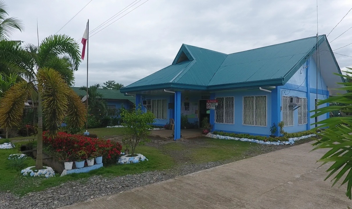
TAMIA
In the northeastern part adjoining the Ngan creek that bounded the outskirts of
Compostela town lays Barangay Tamia. “Tamia” was taken from the name of an old creek that
passed across the center of the barangay.
Based on the research of an American author, H. Otley Bayer, this tract of land was
once a part of one of the territories of the independent Mandayan Chieftain that thrived not only
on the plain of entire Agusan Province, but also on its tributaries.

In 1930s, groups of Visayan immigrant from Negros, Cebu, Bohol and Leyte came in the
place to settle and establish a homestead farm. The settlers of the place named it Upper Ngan.
During the outbreak of the Second World War in 1941, most of the settlers abandoned
their farm to evacuate to a place wherein they believed to be safe from the grim effect of war.
After the Philippine Liberation from the Japanese occupation in 1945, the former settlers who
evacuated from Tamia did not return. Another wave of migration from Visayan Island came and
occupied the place, and they named it Upper Ngan.
In 1954, the Bureau of Lands launched an intensified land distribution program to
accommodate the increasing number of farmers that congested in the agriculture sector. A
public land subdivision survey was conducted to the classified disposable agricultural land areas
to be distributed to the qualified farmers. The tract of land was subdivided into family size lots,
excluding a six- hectare land which was reserved for barangay site where residential lots,
streets, market, school, church and plaza were located.
A proposal was elevated to the Municipal Council of Compostela regarding the creation
of a new barangay separated from Upper Ngan. The Municipal officials wrote a resolution
addressed to the House of Congress through the Office of Governor Almendras requesting the
creation of Barangay Tamia. Barangay Tamia was before a part of Barangay Mangayon. It was
officially declared a separate barangay on May 15, 1956 through the initiative of one pioneer
teacher, Mrs. Luisa O. Fuentes.

A market in the barangay was established in 1974 with an initial number of 5 stores. In
the following year, Mindanao Rice Corporation (MINRICO) entered which adheres to develop
rice production in the locality. In the same year, Davao del Norte Electric Cooperative
(DANECO) energized the barangay. Three houses availed the lighting and power in connection
to Valderrama Lumber Manufacturer & Company, Incorporated.
In 1979, MINRICO was closed. The land used by MINRICO was operated by farmers
who in the long run became land owners.
In 1983, through the Philippine Government, National Irrigators Association (NIA) loaned
13 million (payable within 50 years) from the World Bank in order to finance the irrigation of rice
production.
Compostela Plantation Incorporated (CPI) was established in 1987. The loan by NIA
was received and the construction of the irrigation was undertaken in 1989. The operation of the
irrigation began in 1991.
Subsequently, with regards to the successions of Barangay Captains in Barangay
Tamia, their respective names are listed below.
Its population as determined by the 2020 Census was 3,062. This represented 3.41% of the total population of Compostela.
Demographics
Households
The household population of Tamia in the 2015 Census was 2,872 broken down into 656 households or an average of 4.38 members per household.
details
| Census date | Household population | Number of households | Average household size |
|---|---|---|---|
| 2,075 | 371 | 5.59 | |
| 2,320 | 419 | 5.54 | |
| 2,515 | 479 | 5.25 | |
| 2,296 | 505 | 4.55 | |
| 2,621 | 547 | 4.79 | |
| 2,872 | 656 | 4.38 |
According to the 2015 Census, the age group with the highest population in Tamia is 10 to 14, with 352 individuals. Conversely, the age group with the lowest population is 80 and over, with 22 individuals.
details
Combining age groups together, those aged 14 and below, consisting of the young dependent population which include infants/babies, children and young adolescents/teenagers, make up an aggregate of 33.81% (971). Those aged 15 up to 64, roughly, the economically active population and actual or potential members of the work force, constitute a total of 61.63% (1,770). Finally, old dependent population consisting of the senior citizens, those aged 65 and over, total 4.56% (131) in all.
The computed Age Dependency Ratios mean that among the population of Tamia, there are 55 youth dependents to every 100 of the working age population; there are 7 aged/senior citizens to every 100 of the working population; and overall, there are 62 dependents (young and old-age) to every 100 of the working population.
The median age of 23 indicates that half of the entire population of Tamia are aged less than 23 and the other half are over the age of 23.
| Age group | Population (2015) | Age group percentage |
|---|---|---|
| Under 1 | 56 | 1.95% |
| 1 to 4 | 233 | 8.11% |
| 5 to 9 | 330 | 11.49% |
| 10 to 14 | 352 | 12.26% |
| 15 to 19 | 288 | 10.03% |
| 20 to 24 | 277 | 9.64% |
| 25 to 29 | 211 | 7.35% |
| 30 to 34 | 185 | 6.44% |
| 35 to 39 | 169 | 5.88% |
| 40 to 44 | 166 | 5.78% |
| 45 to 49 | 169 | 5.88% |
| 50 to 54 | 126 | 4.39% |
| 55 to 59 | 98 | 3.41% |
| 60 to 64 | 81 | 2.82% |
| 65 to 69 | 44 | 1.53% |
| 70 to 74 | 29 | 1.01% |
| 75 to 79 | 36 | 1.25% |
| 80 and over | 22 | 0.77% |
| Total | 2,872 | 100.00% |
|
||
The population of Tamia grew from 2,075 in 1990 to 3,062 in 2020, an increase of 987 people over the course of 30 years. The latest census figures in 2020 denote a positive growth rate of 1.36%, or an increase of 190 people, from the previous population of 2,872 in 2015.
| Census date | Population | Growth rate |
|---|---|---|
| 2,075 | – | |
| 2,320 | 2.11% | |
| 2,515 | 1.75% | |
| 2,296 | -1.25% | |
| 2,621 | 4.94% | |
| 2,872 | 1.76% | |
| 3,062 | 1.36% |
Tamia is situated at approximately 7.6995, 126.0984, in the island of Mindanao. Elevation at these coordinates is estimated at 73.5 meters or 241.1 feet above mean sea level.
- Ngan, Compostela, Davao de Oro
- Mangayon, Compostela, Davao de Oro
- Panansalan, Compostela, Davao de Oro
- Mapaca, Compostela, Davao de Oro
- Bagongon, Compostela, Davao de Oro


